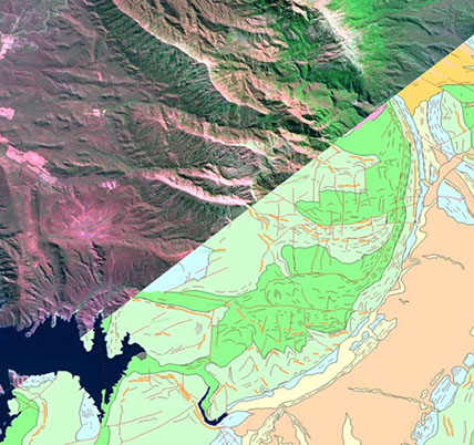
Satellite Image Interpretation
ACA Howe International have completed over 40 satellite image interpretation studies utilising the latest techniques to identify exploration targets through lithostructural and spectral mapping. Our Senior Associate Remote Sensing Geologists have many years’ experience in photogeological and satellite image interpretation and are able to process data ranging from aerial photographs to Landsat and Aster to Very High Resolution (VHR) imagery. In addition to the processing of image data, radar data can be utilised in heavily vegetated areas.
Satellite image interpretation studies have been completed on projects in Africa, Asia, Europe, North America and South America for a range of commodities, including gold, silver, copper, lead, zinc, iron, uranium, tantalum, diamonds and coloured gemstones.
Our Remote Sensing Geologists are experts in their field and were involved in the development of processing techniques to determine the presence of clay-iron alteration in Landsat imagery and argillic, CPS (carbonates, propylites and serpentinites) and phyllic alteration systems in Aster imagery. They are now involved in research on the processing and interpretation of data from the WorldView-3 satellite sensor, launched in 2014.


Our satellite image interpretation services include:
Data acquisition and processing - Assessment of the type of imagery required to suit the needs of the project, liaison with satellite imagery providers and processing as required.
Spectral mapping - Use of the spectral properties of Landsat, Aster and WorldView-3 imagery to identify alteration zones and differentiate between lithologies.
Lithostructural mapping - Features such as faults, fractures, foliation, contacts, dykes, veins and bedding are digitised to provide further geological information and to assist in the identification of target areas.
Target selection and GIS - Targets are selected and prioritised based on the spectral and lithostructural mapping. All features mapped are compiled into a GIS for use in future field and office studies.
If existing VHR satellite imagery does not cover your area of interest, a fast, low cost option is to utilise our UAV Services to acquire high quality, fully georeferenced imagery.
© 2017 A.C.A. Howe International Limited